Error message
Notice: Trying to access array offset on value of type null in IslandoraSolrDisplayManagerResults->currentQueryDisplays() (line 222 of /var/www/drupal7/sites/all/modules/islandora_solr_display_manager/includes/islandora_solr_display_manager.inc).
-
-
Title
-
From A.J. Huntoon to My Dear Lizzie
-
Description
-
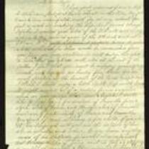
A.J. Huntoon writes a letter from Williamsport in Shawnee County, Kansas to his wife Lizzie, announcing that the country is “in a state of great political excitement” following the seizure of Fort Sumter. The letter, dated April 19, 21, and 22, 1861, states that Confederate supporters tried to raise a Palmetto flag in St. Joseph, Missouri, but Union supporters stopped them. Huntoon informs his wife that militia companies are organizing in Kansas, and he asks her if she objects to him becoming an assistant surgeon for the army. He also relays the news that Gen. Lane has been placed in command of 1,000 men in Washington.
-
Date
-
April 19, 1861-April 22, 1861
-
-
Title
-
From George Collamore to G.L. Stearns
-
Description
-
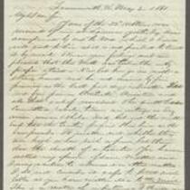
This letter was written on May 2 and 7, 1861 by George Collamore in Leavenworth, Kansas to G.L. Stearns in Boston. Collamore writes that Kansas is under threat of attack from Missouri and the Cherokee and Osage Indians, and that Kansas’s defenses are weak. He reports that Gov. Robinson offered him the position of Quartermaster General of the Kansas Militia, which he temporarily accepted. Collamore asks Stearns to send “thick colored blankets” and other items to Kansas, urging Stearns to keep his activities secret and to be cautious about what he writes in future letters.
-
Object Type
-
Letter
-
Date
-
May 2, 1861 and May 7, 1861
-

-
Title
-
Nebraska and Kanzas
-
Description
-
This color map, ca. 1854-1861, is entitled “Nebraska and Kanzas.” It was printed by J.H. Colton and Co. in New York.
-
Object Type
-
Map
-
Date
-
1854-1861
-

-
Title
-
New Sectional Map of Kansas
-
Description
-
This color map, drafted in 1859 by Robert L. Ream, was published by Stevenson and Morris of St. Louis, and printed by A. Janicke and Co. of St. Louis. The map is entitled “New Sectional Map of Kansas,” and was compiled from the field notes in the Surveyor General’s office.
-
Object Type
-
Map
-
Date
-
1859
-
-
Title
-
From A.J. Huntoon to My Dear Wife
-
Description
-
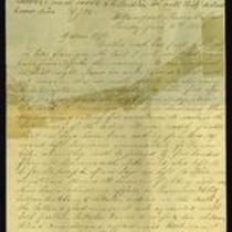
A.J. Huntoon writes a letter from Williamsport in Shawnee County, Kansas to his wife Lizzie, reporting that Rebels have fired at U.S. troops in Independence, Missouri. He adds that hundreds of Kansas troops have left Lawrence and Fort Leavenworth to assist U.S. troops in Kansas City and St. Joseph, Missouri. The letter, dated June 16 and 19, 1861, also mentions recent shootings in Leavenworth and Atchison, Kansas. Huntoon writes, “We may look for these as common occurrences in Kansas, for a while at least. All carry arms now . . . Men are paying out their last cent for them.”
-
Date
-
June 16, 1861-June 19, 1861
-

-
Title
-
Map Showing the Progress of the Public Surveys in the Territories of Kansas and Nebraska
-
Description
-
This black-and-white map, signed by Ward B. Burnett, Surveyor General, was issued by the Surveyor General’s office in Nebraska City, Nebraska Territory on October 1, 1860. The map shows the progress of the public surveys in the territories of Kansas and Nebraska, and was produced to accompany the Surveyor General’s 1860 annual report.
-
Object Type
-
Map
-
Date
-
October 1, 1860
-

-
Title
-
Map Showing the Progress of the Public Surveys in the Territories of Kansas and Nebraska
-
Description
-
This black-and-white map, signed by Ward B. Burnett, Surveyor General, was issued by the Surveyor General’s office in Nebraska City, Nebraska Territory on October 1, 1859. The map shows the progress of the public surveys in the territories of Kansas and Nebraska, and was produced to accompany the Surveyor General’s 1859 annual report.
-
Object Type
-
Map
-
Date
-
October 1, 1859
-

-
Title
-
Map Showing the Progress of the Public Surveys in Kansas and Nebraska
-
Description
-
This black-and-white map, signed by Mark W. Delahay, Surveyor General, was issued by the Surveyor General’s office in Leavenworth, Kansas on September 2, 1861. The map shows the progress of the public surveys in Kansas and Nebraska, and was produced to accompany the Surveyor General’s report of 1861.
-
Object Type
-
Map
-
Date
-
September 2, 1861
-

-
Title
-
Map Showing the Progress of the Public Surveys in the Territories of Kansas and Nebraska
-
Description
-
This black-and-white map, signed by J. Calhoun, Surveyor General, was issued by the Surveyor General’s office in Lecompton, Kansas Territory in October 1857. The map shows the progress of the public surveys in the territories of Kansas and Nebraska, and was produced to accompany the Surveyor General’s 1857 annual report.
-
Date
-
October 1857
