Error message
Notice: Trying to access array offset on value of type null in IslandoraSolrDisplayManagerResults->currentQueryDisplays() (line 222 of /var/www/drupal7/sites/all/modules/islandora_solr_display_manager/includes/islandora_solr_display_manager.inc).
-
-
Title
-
From Florella Brown Adair to Unknown
-
Description
-
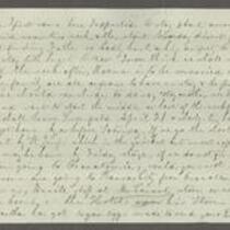
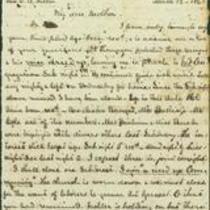
This undated letter was written ca. April 15, 1861 by Florella Brown Adair, presumably to her husband Samuel Lyle Adair. Florella reports that she plans to start for home on April 21, arriving home on the following Saturday. Florella says that Samuel’s father’s health is poor, and that she may attend a family wedding before she leaves Ohio. She writes that Charles and Ada are both well.
-
-
Title
-
From Florella Brown Adair to Samuel Lyle Adair and Emma Adair
-
Description
-
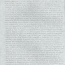
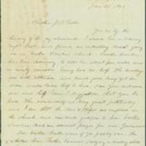
This letter, dated November 8, 1860, was written by Florella Brown Adair in Hudson, Ohio, to her husband Samuel Lyle Adair and daughter Emma Adair in Osawatomie, Kansas. Florella writes that she just returned to Hudson after a trip to Ashtabula, Geauga, and Portage Counties. She says that she will come home if necessary, but is reluctant to because of the present difficult times in Kansas. Florella adds that she came to Ohio “hoping to enjoy the society of my friends once more after being so long shut up in Kansas and I have so far not been disappointed.”
-
Date
-
November 8, 1860
-

-
Title
-
From Florella Brown Adair to Samuel Lyle Adair and Emma Adair
-
Description
-
This letter was written on August 19, 1860 by Florella Brown Adair in Grafton, Ohio, to her husband Samuel Lyle Adair and daughter Emma Adair. Florella describes her journey to Grafton via boat and train with her son Charles and daughter Ada. She says there will soon be a great gathering in Oberlin but expresses reluctance to attend: “I have been so long away from such refined & stilish society that I feel a shrinking from it. Marian thinks I have grown old very fast.”
-
Date
-
August 19, 1860
-
-
Title
-
From M. Jeff Thompson to Robert M. Stewart
-
Description
-
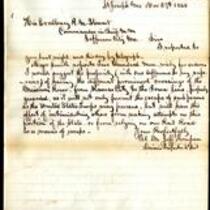
On November 27, 1860, Col. M. Jeff Thompson writes a dispatch from the Headquarters of the 4th Military District in St. Joseph, Missouri to Missouri Gov. R.M Stewart. Thompson suggests that Stewart send troops to guard the Missouri River to prevent the escape of guerrilla attackers and prevent further invasions. Thompson also states that Major F.W. Smith has 200 troops ready for orders.
-
Date
-
November 27, 1860
-
-
Title
-
From M. Jeff Thompson to Robert M. Stewart
-
Description
-
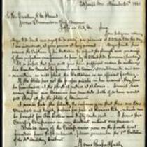
On November 26, 1860, Col. M. Jeff Thompson writes a dispatch from the Headquarters of the 4th Military District in St. Joseph, Missouri to Missouri Gov. R.M Stewart. Thompson reports that Major F.W. Smith is preparing his battalion to be ready for orders. Thompson urges Stewart to authorize Smith’s Quarter Master to procure sufficient arms and ammunitions.
-
Date
-
November 26, 1860
-
-
Title
-
From E.S. Dulin to Jonathan B. Fuller
-
Description
-
This letter, dated March 12, 1863, is from E.S. Dulin, a pastor in St. Joseph, Missouri, to Jonathan B. Fuller, a pastor in Kansas City, Missouri. Dulin describes his community as "worn down" and tells Fuller that "our young men & all others that can are leaving to get rid of being 'Conscripted.'"
-
Date
-
March 12, 1863
-
-
Title
-
From J.A. Hay to Jonathan B. Fuller
-
Description
-
This letter is from J.A. Hay, the uncle of President Lincoln's private secretary, to Rev. Jonathan B. Fuller, a pastor in Kansas City, Missouri. Hay writes from St. Joseph, Missouri on January 30, 1863 and asks Fuller to visit a church in that town. He tells Fuller that the pastor supports the Union and mentions that he was "much gratified to hear brother Doulin make an earnest prayer for our Government."
-
Date
-
January 30, 1863
-

-
Title
-
Sectional Map of Kansas Territory
-
Description
-
This color map, dated April 1857, is entitled "Sectional Map of Kansas Territory." It was drafted by C.P. Wiggin and signed by L.A. MacLean, Chief Clerk of the Surveyor General’s office in Lecompton, Kansas Territory. MacLean certifies that the map was compiled from U.S. survey field notes. The map was published by MacLean and Lawrence and printed by William Schuchman and Bro. in Philadelphia.
-
Object Type
-
Map
-
Date
-
April 1857
-

-
Title
-
Nebraska and Kanzas
-
Description
-
This color map, ca. 1854-1861, is entitled “Nebraska and Kanzas.” It was printed by J.H. Colton and Co. in New York.
-
Object Type
-
Map
-
Date
-
1854-1861
-

-
Title
-
New Sectional Map of Kansas
-
Description
-
This color map, drafted in 1859 by Robert L. Ream, was published by Stevenson and Morris of St. Louis, and printed by A. Janicke and Co. of St. Louis. The map is entitled “New Sectional Map of Kansas,” and was compiled from the field notes in the Surveyor General’s office.
-
Object Type
-
Map
-
Date
-
1859
-

-
Title
-
Map Showing the Progress of the Public Surveys in the Territories of Kansas and Nebraska
-
Description
-
This black-and-white map, signed by Ward B. Burnett, Surveyor General, was issued by the Surveyor General’s office in Nebraska City, Nebraska Territory on October 1, 1860. The map shows the progress of the public surveys in the territories of Kansas and Nebraska, and was produced to accompany the Surveyor General’s 1860 annual report.
-
Object Type
-
Map
-
Date
-
October 1, 1860
-

-
Title
-
Map Showing the Progress of the Public Surveys in the Territories of Kansas and Nebraska
-
Description
-
This black-and-white map, signed by Ward B. Burnett, Surveyor General, was issued by the Surveyor General’s office in Nebraska City, Nebraska Territory on October 1, 1859. The map shows the progress of the public surveys in the territories of Kansas and Nebraska, and was produced to accompany the Surveyor General’s 1859 annual report.
-
Object Type
-
Map
-
Date
-
October 1, 1859
-

-
Title
-
Map Showing the Progress of the Public Surveys in Kansas and Nebraska
-
Description
-
This black-and-white map, signed by Mark W. Delahay, Surveyor General, was issued by the Surveyor General’s office in Leavenworth, Kansas on September 2, 1861. The map shows the progress of the public surveys in Kansas and Nebraska, and was produced to accompany the Surveyor General’s report of 1861.
-
Object Type
-
Map
-
Date
-
September 2, 1861
-

-
Title
-
Map Showing the Progress of the Public Surveys in the Territories of Kansas and Nebraska
-
Description
-
This black-and-white map, signed by Ward B. Burnett, Surveyor General, was issued by the Surveyor General’s office in Nebraska City, Nebraska Territory on October 1, 1858. The map depicts the progress of the public surveys in Kansas and Nebraska in 1858, and was created to accompany the Surveyor General's report of that year. The map was printed by C.B. Graham Lithographers in Washington, DC.
-
Date
-
October 1, 1858
-

-
Title
-
Map Showing the Progress of the Public Surveys in the Territories of Kansas and Nebraska
-
Description
-
This black-and-white map, signed by J. Calhoun, Surveyor General, was issued by the Surveyor General’s office in Lecompton, Kansas Territory in October 1857. The map shows the progress of the public surveys in the territories of Kansas and Nebraska, and was produced to accompany the Surveyor General’s 1857 annual report.
-
Date
-
October 1857
