Error message
Notice: Trying to access array offset on value of type null in IslandoraSolrDisplayManagerResults->currentQueryDisplays() (line 222 of /var/www/drupal7/sites/all/modules/islandora_solr_display_manager/includes/islandora_solr_display_manager.inc).
-
-
Title
-
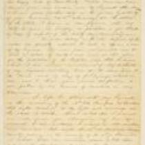
From G.W. Veale to George W. Dietzler
-
Description
-
On October 30, 1864, this dispatch was sent by Col. G.W. Veale at Headquarters, 2nd Regiment, Kansas State Militia in Topeka, Kansas, to Maj. Gen. Dietzler, Comm. Kansas State Militia. Veale reports on a recent campaign in which his regiment moved from Topeka to Shawneetown in Johnson County, Kansas, to Jackson County, Missouri, where it fought in the Battle of the Blue on October 22, 1864. Veale states that his regiment lost 44 killed and wounded, with 68 men taken prisoner after fighting “a force six times our number for three quarters of an hour.” The dispatch includes a list of the soldiers killed and wounded in the battle.
-
Date
-
October 30, 1864
-

-
Title
-
New Sectional Map of Kansas
-
Description
-
This color map, drafted in 1859 by Robert L. Ream, was published by Stevenson and Morris of St. Louis, and printed by A. Janicke and Co. of St. Louis. The map is entitled “New Sectional Map of Kansas,” and was compiled from the field notes in the Surveyor General’s office.
-
Object Type
-
Map
-
Date
-
1859
-

-
Title
-
Sectional Map of the Territory of Kansas
-
Description
-
This color map, entitled “Sectional Map of the Territory of Kansas,” was compiled from the field notes in the Surveyor General’s office. It was published in 1857 by John Halsall in St. Louis.
-
Object Type
-
Map
-
Date
-
1857
-

-
Title
-
Map Showing the Progress of the Public Surveys in the Territories of Kansas and Nebraska
-
Description
-
This black-and-white map, signed by Ward B. Burnett, Surveyor General, was issued by the Surveyor General’s office in Nebraska City, Nebraska Territory on October 1, 1859. The map shows the progress of the public surveys in the territories of Kansas and Nebraska, and was produced to accompany the Surveyor General’s 1859 annual report.
-
Object Type
-
Map
-
Date
-
October 1, 1859
