
The missouri-kansas conflict 1854-1865
Error message
Notice: Trying to access array offset on value of type null in IslandoraSolrDisplayManagerResults->currentQueryDisplays() (line 222 of /var/www/drupal7/sites/all/modules/islandora_solr_display_manager/includes/islandora_solr_display_manager.inc).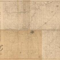

Object Type
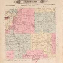
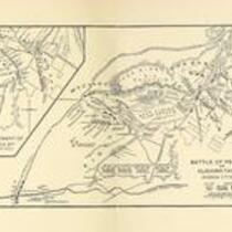
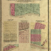
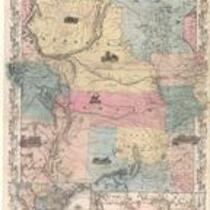
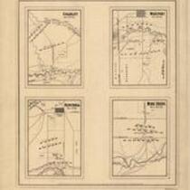
- Map (19)
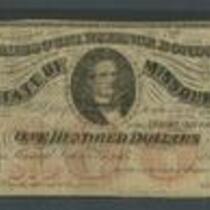
- Currency (3)
- Newspaper Article (2)
- Government Document (1)
- Leaflet (1)
Local Subject
- Picturing the War (43)
- Bleeding Kansas, Bloodletting Missouri (20)
- American Indians (17)
- Battle for Missouri, 1861-1865 -- Military History of Missouri and Kansas (7)
- Surviving a Guerrilla War (5)
- Missouri military units (Confederate) (4)
- Missouri military units (Union) (4)
- African Americans (2)
- Battle of Hemp Bales / Battle of Lexington (2)
- Kansas-Nebraska Act (2)
- Popular Sovereignty (2)
- Battle of Mine Creek (1)
- Battle of Newtonia (First) (1)
- Battle of Westport (1)
- Bushwhackers (1)
- Guerrillas (1)
- Kansas military units (1)
- Quantrill's Raid on Lawrence (1)
- Sack of Lawrence (First) (1)
- Women (1)
People
- J. Calhoun (3)
- State of Missouri (3)
- J.H. Colton and Co. (Lithographer) (2)
- Jefferson Davis (2)
- Ward B. Burnett (2)
- A. Hoen and Co. (Lithographer) (1)
- A. Janicke and Co. (Lithographer) (1)
- A. Konig (1)
- Abraham Lincoln (1)
- Ackerman Lithographers (1)
- Andrew Reeder (1)
- Benjamin Singleton (1)
- Bowen and Co. Lithographers (1)
- C.B. Graham Lithographers (1)
- C.P. Wiggin (1)
- Claiborne Fox Jackson (1)
- Col. Dodge (1)
- E. Anthony (1)
- E. F. Heisler & D. M. Smith (1)
- Edwards Brothers of Missouri (1)
- Edwin Hergesheimer (1)
- F.L. Scott (1)
- G. W. Brown & Co. (1)
- Geo. A. Ogle & Co. (1)
- H.T. Anthony (1)
- Hamilton R. Gamble (1)
- Henry S. Graham (1)
- Isaac Cooper Stuck (1)
- J. A. Wilson (1)
- J. Bien (Lithographer) (1)
- J. Cooper Stuck (1)
- J. Disturnell (1)
- J.Bien (Lithographer) (1)
- J.C. Jones (1)
- J.G. Wells (Lithographer) (1)
- J.H. Colton and Co. (1)
- J.M. Bassett (1)
- James Montgomery (1)
- John C. Fremont (1)
- John Halsall (1)
- Joseph Orville Shelby (1)
- Leonard & Martin (1)
- Lieut. Steen (1)
- M.B. Davis (1)
- MacLean and Lawrence (1)
- Mark W. Delahay (1)
- N. Shields (1)
- North West Publishing Co. (1)
- North West Publishing Company (1)
- Robert L. Ream (1)
Geographic Subject
- Fort Leavenworth, Kansas (14)
- Leavenworth County, Kansas (13)
- Douglas County, Kansas (12)
- Lawrence, Kansas (12)
- Lecompton, Kansas (11)
- Atchison, Kansas (10)
- Kansas City, Missouri (10)
- Atchison County, Kansas (9)
- Buchanan County, Missouri (9)
- Doniphan County, Kansas (9)
- Jackson County, Missouri (9)
- Leavenworth, Kansas (9)
- St. Joseph, Missouri (9)
- Wyandotte County, Kansas (9)
- Bourbon County, Kansas (8)
- Fort Scott, Kansas (8)
- Shawnee County, Kansas (8)
- Topeka, Kansas (8)
- Johnson County, Kansas (6)
- Franklin County, Kansas (4)
- Linn County, Kansas (4)
- Clay County, Missouri (3)
- Jackson County, Kansas (3)
- Quindaro, Kansas (3)
- Weston, Missouri (3)
- Andrew County, Missouri (2)
- Brown County, Kansas (2)
- Fort Riley, Kansas (2)
- Holt County, Missouri (2)
- Jefferson County, Kansas (2)
- Nodaway County, Missouri (2)
- Platte County, Missouri (2)
- Atchison County, Missouri (1)
- Bates County, Missouri (1)
- Carroll County, Missouri (1)
- Cass County, Missouri (1)
- Chariton County, Missouri (1)
- Clinton County, Missouri (1)
- Dekalb County, Missouri (1)
- Harrison County, Missouri (1)
- Henry County, Missoui (1)
- Independence, Missouri (1)
- Johnson County, Missouri (1)
- Lafayette County, Missouri (1)
- Lexington, Missouri (1)
- Liberty, Missouri (1)
- Linn County, Missouri (1)
- Livingston County, Missouri (1)
- Mercer County, Missouri (1)
- Osage County, Kansas (1)
Owning Organization
- Lecompton Historical Society (17)
- Kansas Historical Society (4)
- State Historical Society of Missouri - Columbia (4)
- Library of Congress Prints and Photographs Division (3)
- Library of Congress (2)
- Library of Congress Geography and Map Division (2)
- State Historical Society of Missouri – Columbia (2)
- Harvard University (1)
- Internet Archive (1)
- Jackson County Historical Society (1)
- Johnson County Museum (1)
- Nancy Hillyard Hampton Library and Archival Center (1)
- National Park Service (1)
- St. Joseph Public Library (1)
- State Historical Society of Missouri – Kansas City (1)
- Watkins Community Museum of History (1)