
The missouri-kansas conflict 1854-1865
Error message
Notice: Trying to access array offset on value of type null in IslandoraSolrDisplayManagerResults->currentQueryDisplays() (line 222 of /var/www/drupal7/sites/all/modules/islandora_solr_display_manager/includes/islandora_solr_display_manager.inc).


Object Type
- Image (388)
- Government Document (322)
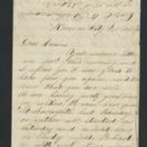
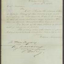
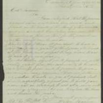
- Letter (103)
- Legal Document (69)
- Map (20)
- Petition (17)
- Newspaper Article (9)
- Broadside (8)
- Diary (8)
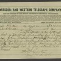
- Telegram (8)
Local Subject
- Surviving a Guerrilla War (609)
- Battle for Missouri, 1861-1865 -- Military History of Missouri and Kansas (565)
- Missouri military units (Union) (483)
- Picturing the War (430)
- Bleeding Kansas, Bloodletting Missouri (381)
- Guerrillas (265)
- African Americans (213)
- Women (196)
- Presidential Election of 1860, Secession, and the War's Commencement (118)
- Bushwhackers (112)
- Border Ruffians (108)
- Jayhawkers (96)
- Missouri military units (Confederate) (82)
- Popular Sovereignty (58)
- American Indians (47)
- Battle of Hemp Bales / Battle of Lexington (33)
- Bogus Legislature (28)
- Kansas-Nebraska Act (25)
- Quantrill's Raid on Lawrence (23)
- Order No. 11 (14)
- Lecompton Constitutional Convention (10)
- Missouri Expedition / Price's Raid (10)
- Battle of Westport (9)
- Out-of-state military units serving in Missouri (9)
- Underground Railroad (9)
- Battle of Wilson's Creek (8)
- Wakarusa War (8)
- Out-of-state military units serving in Kansas (6)
- Sack of Lawrence (First) (6)
- Topeka Constitutional Convention (6)
- Battle at Osawatomie (5)
- Battle of Byram's Ford (3)
- Wyandotte Constitutional Convention (3)
- Battle of Fort Titus (2)
- Battle of Hickory Point (2)
- Battle of Lexington (Second) (2)
- Battle of Mine Creek (2)
- Camp Jackson Affair (2)
- Leavenworth Constitutional Convention (2)
- Battle for Missouri, Picturing the War, Out-of-state military units serving in Missouri (1)
- Battle of Black Jack (1)
- Battle of Blackwater River / Battle of Milford (1)
- Battle of Boonville (1)
- Battle of Carthage (1)
- Battle of Franklin (1)
- Battle of Independence (First) (1)
- Battle of Independence (Second) (1)
- Battle of Island Mound (1)
- Battle of Liberty (1)
- Battle of Lone Jack (1)
People
- Abraham Lincoln (61)
- James Henry Lane (49)
- Sterling Price (45)
- James Montgomery (35)
- John W Geary (35)
- John A. Bushnell (33)
- Anna Lee (Dillenbeck) Stacey (31)
- E.B. Alexander (30)
- James J. Akard (29)
- John Brown (29)
- William Clarke Quantrill (29)
- Florella Brown Adair (28)
- --> (26)
- Edward Fitch (24)
- Charles Robinson (20)
- Wilson Shannon (19)
- Andrew Reeder (18)
- Franklin Pierce (17)
- Elmer Stewart (16)
- James M. Boyer (16)
- Hamilton R Gamble (15)
- Stephen A Douglas (15)
- Daniel Woodson (13)
- Frederick Starr (13)
- Charles Adair (12)
- Thomas E Ewing (12)
- John W. Geary (10)
- Samuel J Jones (10)
- A. Comingo (9)
- Eugenia Bronaugh (9)
- H.C. Wood (9)
- Jefferson Davis (9)
- Joseph Orville Shelby (9)
- Kurz & Allison (9)
- Samuel R Curtis (9)
- Alex M. Bedford (8)
- G.A. Parsons (8)
- John C Fremont (8)
- Mary E. Bedford (8)
- A. Ruger (7)
- Alexander Gardner (7)
- Currier & Ives Lithography Company (7)
- Robert M. Stewart (7)
- A.F. Cox (6)
- A.M. Bedford (6)
- Alfred H. Offutt (6)
- Charles Johnson (6)
- Hosea G. Mullings (6)
- James Griffing (6)
- Nathaniel Lyon (6)
Geographic Subject
- Clay County, Missouri (320)
- Liberty, Missouri (303)
- Douglas County, Kansas (144)
- Lafayette County, Missouri (126)
- Jackson County, Missouri (122)
- Lexington, Missouri (114)
- Lawrence, Kansas (100)
- Kansas City, Missouri (76)
- Leavenworth County, Kansas (76)
- Buchanan County, Missouri (62)
- Leavenworth, Kansas (61)
- Miami County, Kansas (61)
- St. Joseph, Missouri (60)
- Lecompton, Kansas (59)
- Chariton County, Missouri (58)
- Bates County, Missouri (55)
- Platte County, Missouri (49)
- Shawnee County, Kansas (48)
- Topeka, Kansas (46)
- Independence, Missouri (43)
- Fort Leavenworth, Kansas (40)
- Andrew County, Missouri (38)
- Cass County, Missouri (32)
- Saline County, Missouri (29)
- Henry County, Missoui (28)
- Vernon County, Missouri (28)
- Weston, Missouri (28)
- Bourbon County, Kansas (26)
- Fort Scott, Kansas (24)
- Carroll County, Missouri (23)
- Ray County, Missouri (23)
- Cooper County, Missouri (22)
- Howard County, Missouri (21)
- Linn County, Kansas (21)
- Atchison, Kansas (19)
- Johnson County, Missouri (19)
- Atchison County, Kansas (18)
- Clinton County, Missouri (18)
- Wyandotte County, Kansas (17)
- Johnson County, Kansas (16)
- Caldwell County, Missouri (14)
- Doniphan County, Kansas (14)
- Holt County, Missouri (11)
- Nodaway County, Missouri (11)
- Fort Riley, Kansas (10)
- Dekalb County, Missouri (9)
- Franklin County, Kansas (9)
- Jefferson County, Kansas (9)
- Gentry County, Missouri (8)
- Linn County, Missouri (8)
Owning Organization
- Charles F. Curry Library, William Jewell College (286)
- Missouri Valley Special Collections (252)
- Kansas Historical Society (211)
- National Archives at Kansas City (179)
- Library of Congress Prints and Photographs Division (131)
- Missouri State Archives (85)
- State Historical Society of Missouri – Columbia (76)
- State Historical Society of Missouri – Kansas City (55)
- Missouri Historical Society Library and Research Center (42)
- Internet Archive (37)
- Watkins Community Museum of History (33)
- Jackson County Historical Society (18)
- Wikimedia Commons (18)
- Kenneth Spencer Research Library (17)
- Lecompton Historical Society (17)
- Battle of Lexington State Historic Site (16)
- State Historical Society of Missouri - Columbia (13)
- National Portrait Gallery, Smithsonian Institution (11)
- Baker University (8)
- Nancy Hillyard Hampton Library and Archival Center (8)
- Bushwhacker Museum (6)
- Cass County Historical Society (6)
- Harry S. Truman Library and Museum (6)
- Library of Congress (6)
- Bates County Historical Society (5)
- National Museum of American History, Kenneth E. Behring Center, Smithsonian Institution (5)
- National Park Service (4)
- Inventories of American Painting and Sculpture, Smithsonian American Art Museum (3)
- Library of Congress Geography and Map Division (3)
- Nodaway County Historical Society (3)
- Confederate Memorial State Historic Site (2)
- Jackson County Records Center (2)
- Johnson County Missouri Historical Society (2)
- Johnson County Museum (2)
- Lone Jack Historical Society (2)
- National Archives and Records Administration at Kansas City (2)
- National Museum of Civil War Medicine (2)
- Princeton University (2)
- Austin Public Library (1)
- Beinecke Rare Book & Manuscript Library (1)
- Bethany Wears Photography (1)
- BlackPast.org (1)
- Boston Public Library (1)
- Combatphoto44 on Flickr (1)
- Cornell University (1)
- David M. Rubenstein Rare Book & Manuscript Library, Duke University (1)
- Fishburn Archives, McAfee Memorial Library (1)
- Harvard College Library (1)
- Harvard Library (1)
- Harvard University (1)