Error message
Notice: Trying to access array offset on value of type null in IslandoraSolrDisplayManagerResults->currentQueryDisplays() (line 222 of /var/www/drupal7/sites/all/modules/islandora_solr_display_manager/includes/islandora_solr_display_manager.inc).
-
-
Title
-
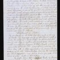
From Frederick Starr to My Dear Father
-
Description
-
On March 19, 1855, Frederick Starr writes from Weston, Missouri to his father. Starr transcribes a recent article from the local newspaper “Liberty Platform,” in which he is accused of being a “political priest” in charge of a “gang” of abolitionists. Starr believes the article makes unjust and false statements about him, but admits “it may be the impression which has fixed itself upon the minds of the fire eating part of the community. If so I would not have it otherwise.” The article also describes the nomination of Gen. Whitfield as the Kansas Territory delegate to Congress.
-
Date
-
March 19, 1855
-
-
Title
-
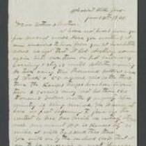
From George Miller to Dear Father and Mother
-
Description
-
This letter, dated January 14, 1861, is from George Miller in Pleasant Hill, Cass County, Missouri, to his parents. Miller writes that Lt. Col. Daniel R. Anthony and his Kansas troops invaded Pleasant Hill, stealing 55 slaves and $10,000 worth of property. He complains that the Missouri Secessionists are "fast beginning to give up the contest" and laments that "the country is being ruined."
-
Object Type
-
Letter
-
Date
-
January 14, 1861
-

-
Title
-
New Sectional Map of Kansas
-
Description
-
This color map, drafted in 1859 by Robert L. Ream, was published by Stevenson and Morris of St. Louis, and printed by A. Janicke and Co. of St. Louis. The map is entitled “New Sectional Map of Kansas,” and was compiled from the field notes in the Surveyor General’s office.
-
Object Type
-
Map
-
Date
-
1859
-

-
Title
-
Sectional Map of the Territory of Kansas
-
Description
-
This color map, entitled “Sectional Map of the Territory of Kansas,” was compiled from the field notes in the Surveyor General’s office. It was published in 1857 by John Halsall in St. Louis.
-
Object Type
-
Map
-
Date
-
1857
-

-
Title
-
Map Showing the Progress of the Public Surveys in the Territories of Kansas and Nebraska
-
Description
-
This black-and-white map, signed by Ward B. Burnett, Surveyor General, was issued by the Surveyor General’s office in Nebraska City, Nebraska Territory on October 1, 1858. The map depicts the progress of the public surveys in Kansas and Nebraska in 1858, and was created to accompany the Surveyor General's report of that year. The map was printed by C.B. Graham Lithographers in Washington, DC.
-
Date
-
October 1, 1858
