Error message
Notice: Trying to access array offset on value of type null in IslandoraSolrDisplayManagerResults->currentQueryDisplays() (line 222 of /var/www/drupal7/sites/all/modules/islandora_solr_display_manager/includes/islandora_solr_display_manager.inc).
-
-
Title
-
From S.G. Cato to John W. Geary
-
Description
-
This letter, dated October 29, 1856, is from Judge S.G. Cato in Shawnee County, Kansas to Gov. John W. Geary. Cato reports on the judicial proceedings he has presided over as Associate Justice of the Kansas Supreme Court. He lists the number of bills of indictment returned by grand juries in Anderson, Allen, Lykins, Bourbon, Franklin, and Shawnee counties, and reports that three criminal trials have been held in Bourbon County.
-
Date
-
October 29, 1856
-
-
Title
-
From Edmund G. Ross to My Dear Wife
-
Description
-
Edmund G. Ross, a captain in the 11th Kansas Cavalry, writes a letter to his wife on June 15, 1864. He informs her that he has just arrived in Olathe from Lawrence, Kansas, and has heard rumors of “a great scare along the border” of Kansas and Missouri. Ross predicts that Kansas troops will soon cross into Missouri to fight the Bushwhackers.
-
Date
-
June 15, 1864
-
-
Title
-
From E.S. Lowman to Charles Robinson
-
Description
-
This letter was written by E.S. Lowman in Paola, Kansas, to Kansas Gov. Charles Robinson on August 13, 1861. Lowman writes that the citizens of Olathe, Kansas were recently in a state of “confusion and alarm,” fearing invasion by guerrillas. After the local sheriff arrested several suspected guerrillas from a “secret organization,” the situation settled down. Lowman believes that Aubrey, Kansas is at risk of attack by “’Jayhawkers’ from both sides of the line,” and states that he delivered additional arms to troops stationed there. He also describes recent efforts by law enforcement to recover property stolen by Jayhawkers.
-
Date
-
August 13, 1861
-

-
Title
-
Sectional Map of Kansas Territory
-
Description
-
This color map, dated April 1857, is entitled "Sectional Map of Kansas Territory." It was drafted by C.P. Wiggin and signed by L.A. MacLean, Chief Clerk of the Surveyor General’s office in Lecompton, Kansas Territory. MacLean certifies that the map was compiled from U.S. survey field notes. The map was published by MacLean and Lawrence and printed by William Schuchman and Bro. in Philadelphia.
-
Object Type
-
Map
-
Date
-
April 1857
-

-
Title
-
New Sectional Map of Kansas
-
Description
-
This color map, drafted in 1859 by Robert L. Ream, was published by Stevenson and Morris of St. Louis, and printed by A. Janicke and Co. of St. Louis. The map is entitled “New Sectional Map of Kansas,” and was compiled from the field notes in the Surveyor General’s office.
-
Object Type
-
Map
-
Date
-
1859
-

-
Title
-
Sectional Map of the Territory of Kansas
-
Description
-
This color map, entitled “Sectional Map of the Territory of Kansas,” was compiled from the field notes in the Surveyor General’s office. It was published in 1857 by John Halsall in St. Louis.
-
Object Type
-
Map
-
Date
-
1857
-

-
Title
-
Kansas and Nebraska 1856
-
Description
-
This color map, entitled “Kansas and Nebraska 1856,” was printed by J.G. Wells in New York.
-
Object Type
-
Map
-
Date
-
1856
-
-
Title
-
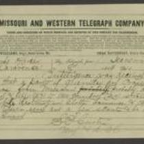
From Samuel R. Curtis to Edmund G. Ross
-
Description
-
This telegram, dated 1864, is from Major Samuel R. Curtis at Fort Leavenworth to Edmund G. Ross in Lawrence, Kansas. Curtis reports that 150-200 Missouri guerrillas have entered Kansas and are likely to invade Olathe, Lawrence, and Topeka. He tells Ross to warn Topeka of a possible attack and urges him to “be on your guard.”
-
Object Type
-
Telegram
-
Date
-
1864
-

-
Title
-
Map Showing the Progress of the Public Surveys in the Territories of Kansas and Nebraska
-
Description
-
This black-and-white map, signed by Ward B. Burnett, Surveyor General, was issued by the Surveyor General’s office in Nebraska City, Nebraska Territory on October 1, 1859. The map shows the progress of the public surveys in the territories of Kansas and Nebraska, and was produced to accompany the Surveyor General’s 1859 annual report.
-
Object Type
-
Map
-
Date
-
October 1, 1859
