Error message
Notice: Trying to access array offset on value of type null in IslandoraSolrDisplayManagerResults->currentQueryDisplays() (line 222 of /var/www/drupal7/sites/all/modules/islandora_solr_display_manager/includes/islandora_solr_display_manager.inc).
Pages
-
-
Title
-
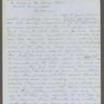
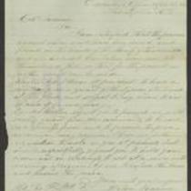
From Daniel Woodson to William Hutchinson and H. Miles Moore
-
Description
-
This letter, dated September 3, 1856, was written by Acting Kansas Gov. Daniel Woodson at Lecompton, Kansas to William Hutchinson and H. Miles Moore in behalf of the Kansas State Central Committee. Woodson states that he received their letter asserting that a deputation from their committee is being illegally detained at Lecompton. Woodson replies that although he met with two men from the committee, they did not represent themselves as a deputation and were rightly arrested as spies.
-
Date
-
September 3, 1856
-
-
Title
-
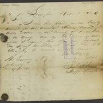
From Samuel Jones to John W. Geary
-
Description
-
Samuel Jones, Sheriff of Douglas County, Kansas, writes a letter to Gov. John W. Geary on November 15, 1856. He informs Geary that he has a warrant to arrest Thomas Addy. He states that he anticipates Addy will resist, and he requests that Geary send troops to aid in the arrest.
-
Date
-
November 15, 1856
-
-
Title
-
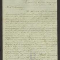
From Wilson Shannon to E.V. Sumner
-
Description
-
This dispatch, dated May 21, 1856, was sent by Kansas Gov. Wilson Shannon in Lecompton, Kansas, to Col. E.V. Sumner at Headquarters, Fort Leavenworth, Kansas. Due to recent civil unrest in Lawrence, Kansas, Shannon instructs Sumner to station companies of U.S. troops at or near Lawrence, Lecompton, and Topeka, Kansas. Shannon explains that federal troops are the only ones he feels safe using in response to “these civil commotions.” He notes that the U.S. Marshal has made several arrests for the crime of high treason.
-
Date
-
May 21, 1856
-

-
Title
-
Sectional Map of Kansas Territory
-
Description
-
This color map, dated April 1857, is entitled "Sectional Map of Kansas Territory." It was drafted by C.P. Wiggin and signed by L.A. MacLean, Chief Clerk of the Surveyor General’s office in Lecompton, Kansas Territory. MacLean certifies that the map was compiled from U.S. survey field notes. The map was published by MacLean and Lawrence and printed by William Schuchman and Bro. in Philadelphia.
-
Object Type
-
Map
-
Date
-
April 1857
-

-
Title
-
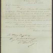
From Wilson Shannon to E.V. Sumner
-
Description
-
This dispatch, dated June 23, 1856, was sent by Kansas Gov. Wilson Shannon in Lecompton, Kansas, to Col. E.V. Sumner. Shannon, who says he will soon leave for St. Louis, urges Sumner to attend the meeting of the Topeka legislature. Shannon indicates that he fears an outbreak of violence will occur if U.S. troops are withdrawn from Kansas, and says he will write to President Pierce saying so. Shannon requests that Sumner make no changes with the troops until he returns in ten days’ time.
-
Date
-
June 23, 1856
-

-
Title
-
Nebraska and Kanzas
-
Description
-
This color map, ca. 1854-1861, is entitled “Nebraska and Kanzas.” It was printed by J.H. Colton and Co. in New York.
-
Object Type
-
Map
-
Date
-
1854-1861
-

-
Title
-
New Sectional Map of Kansas
-
Description
-
This color map, drafted in 1859 by Robert L. Ream, was published by Stevenson and Morris of St. Louis, and printed by A. Janicke and Co. of St. Louis. The map is entitled “New Sectional Map of Kansas,” and was compiled from the field notes in the Surveyor General’s office.
-
Object Type
-
Map
-
Date
-
1859
-

-
Title
-
From Wilson Shannon to E.V. Sumner
-
Description
-
This dispatch, dated June 4, 1856, was sent by Kansas Gov. Wilson Shannon in Lecompton, Kansas, to Col. E.V. Sumner at Headquarters, Fort Leavenworth, Kansas. Shannon has received reliable information that the town of Franklin, Kansas was attacked by about 150 armed men the previous night, leaving one man dead and five or six taken prisoner. Shannon hopes that Sumner will take prompt action to stop “these outrages.” Shannon adds that a proclamation is being prepared and he will send copies to Sumner.
-
Date
-
June 4, 1856
-

-
Title
-
Sectional Map of the Territory of Kansas
-
Description
-
This color map, entitled “Sectional Map of the Territory of Kansas,” was compiled from the field notes in the Surveyor General’s office. It was published in 1857 by John Halsall in St. Louis.
-
Object Type
-
Map
-
Date
-
1857
-

-
Title
-
Kansas and Nebraska 1856
-
Description
-
This color map, entitled “Kansas and Nebraska 1856,” was printed by J.G. Wells in New York.
-
Object Type
-
Map
-
Date
-
1856
-
-
Title
-
From Wilson Shannon to E.V. Sumner
-
Description
-
This dispatch, dated June 4, 1856, was sent by Kansas Gov. Wilson Shannon to Col. E.V. Sumner. Shannon informs Sumner that Col. Preston, Deputy Sheriff of Douglas County, Kansas, will accompany the U.S. troops “so as to be ready to act as circumstances may require.”
-
Date
-
June 4, 1856
-
-
Title
-
From Wilson Shannon to E.V. Sumner
-
Description
-
This dispatch, dated April 25, 1856, was sent by Kansas Gov. Wilson Shannon in Lecompton, Kansas, to Col. E.V. Sumner at Headquarters, Fort Leavenworth, Kansas. Shannon requests that a force of 30 U.S. troops be stationed at Lecompton in case of an emergency. Shannon asks Sumner to keep his troops ready to act at a moment’s notice “if required by me to enforce the laws and preserve the peace.”
-
Date
-
April 25, 1856
-

-
Title
-
Map Showing the Progress of the Public Surveys in the Territories of Kansas and Nebraska
-
Description
-
This black-and-white map, signed by Ward B. Burnett, Surveyor General, was issued by the Surveyor General’s office in Nebraska City, Nebraska Territory on October 1, 1860. The map shows the progress of the public surveys in the territories of Kansas and Nebraska, and was produced to accompany the Surveyor General’s 1860 annual report.
-
Object Type
-
Map
-
Date
-
October 1, 1860
-

-
Title
-
Map Showing the Progress of the Public Surveys in the Territories of Kansas and Nebraska
-
Description
-
This black-and-white map, signed by Ward B. Burnett, Surveyor General, was issued by the Surveyor General’s office in Nebraska City, Nebraska Territory on October 1, 1859. The map shows the progress of the public surveys in the territories of Kansas and Nebraska, and was produced to accompany the Surveyor General’s 1859 annual report.
-
Object Type
-
Map
-
Date
-
October 1, 1859
-

-
Title
-
Map Showing the Progress of the Public Surveys in Kansas and Nebraska
-
Description
-
This black-and-white map, signed by Mark W. Delahay, Surveyor General, was issued by the Surveyor General’s office in Leavenworth, Kansas on September 2, 1861. The map shows the progress of the public surveys in Kansas and Nebraska, and was produced to accompany the Surveyor General’s report of 1861.
-
Object Type
-
Map
-
Date
-
September 2, 1861
-

-
Title
-
From Wilson Shannon to E.V. Sumner
-
Description
-
This dispatch, dated April 20, 1856, was sent by Kansas Gov. Wilson Shannon in Lecompton, Kansas, to Col. E.V. Sumner. Shannon states that after Douglas County Sheriff Samuel J. Jones arrested a man named S.N. Wood, he was forcibly rescued by a band of men. In order to recapture Wood and make several additional arrests, Shannon instructs Sumner to send an officer and six U.S. troops to Lecompton to assist Jones. Shannon indicates that he prefers to employ U.S. troops for this purpose because of their political neutrality.
-
Date
-
April 20, 1856
-

-
Title
-
Map Showing the Progress of the Public Surveys in the Territories of Kansas and Nebraska
-
Description
-
This black-and-white map, signed by Ward B. Burnett, Surveyor General, was issued by the Surveyor General’s office in Nebraska City, Nebraska Territory on October 1, 1858. The map depicts the progress of the public surveys in Kansas and Nebraska in 1858, and was created to accompany the Surveyor General's report of that year. The map was printed by C.B. Graham Lithographers in Washington, DC.
-
Date
-
October 1, 1858
-

-
Title
-
Map Showing the Progress of the Public Surveys in the Territories of Kansas and Nebraska
-
Description
-
This black-and-white map, signed by J. Calhoun, Surveyor General, was issued by the Surveyor General’s office in Lecompton, Kansas Territory in October 1857. The map shows the progress of the public surveys in the territories of Kansas and Nebraska, and was produced to accompany the Surveyor General’s 1857 annual report.
-
Date
-
October 1857
-
-
Title
-
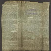
Letter From Judge Lecompte
-
Description
-
This September 13, 1856 newspaper article is an open letter from Judge Samuel Lecompte to James A. Stewart, a Maryland Congressman. In the letter, Lecompte defends himself against several charges; he denies that he packed the jury in a murder trial, that he was in possession of illegal whisky, that he misrepresented the crime of treason to a grand jury, and that he participated in a meeting of the Law and Order Party. He states that he is aware of threats to remove him from his post as Chief Justice of Kansas Territory, but he insists that he has been a fair and impartial judge.
-
Object Type
-
Newspaper Article
-
Date
-
September 13, 1856
Pages
