Error message
Notice: Trying to access array offset on value of type null in IslandoraSolrDisplayManagerResults->currentQueryDisplays() (line 222 of /var/www/drupal7/sites/all/modules/islandora_solr_display_manager/includes/islandora_solr_display_manager.inc).
-
-
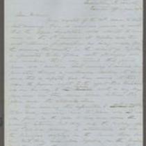
Title
-
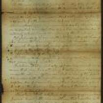
Proceedings of the Citizens of Tecumseh
-
Description
-
This document details the proceedings of a meeting of Tecumseh, Kansas citizens held at the Tecumseh courthouse on November 26, 1856. The attendees appointed 12 men to serve as delegates at an upcoming convention in Leavenworth. They also voted on and approved several resolutions, including a commitment to establishing peace in Kansas, and an agreement to support Gov. John W. Geary. The document is dated November 29, 1856 and is signed by 18 citizens.
-
Object Type
-
Document
-
Date
-
November 29, 1856
-
-
Title
-
From Edward Fitch to Dear Parents
-
Description
-
Edward Fitch of Lawrence, Kansas, writes a letter to his parents in Massachusetts on August 9, 1857, announcing that Kansas has voted to ratify the Topeka Constitution. He adds that Free State supporters appear to comprise a majority in Kansas. Fitch complains about a recent Herald of Freedom article on the apportionment of the Kansas Legislature, and claims that it is “the most damning piece of villany ever perpetrated by any men or set of men.”
-
Date
-
August 9, 1857
-

-
Title
-
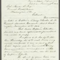
From John M. Schofield to Thomas Carney
-
Description
-
This letter, written on the letterhead of Headquarters, Department of the Missouri and dated August 29, 1863, was sent by John M. Schofield in St. Louis to Kansas Governor Thomas Carney in Topeka, Kansas. Writing in the aftermath of Quantrill’s raid on Lawrence, Kansas, Major General Schofield states his hope that President Lincoln will appoint a Court of Inquiry to investigate the raid. Schofield refers to a meeting proposed for September 8, 1863 in Paola, Kansas, in which participants plan to enter Missouri “to recover their stolen property.” Schofield emphasizes the need to preempt this potentially violent meeting.
-
Date
-
August 29, 1863
-
-
Title
-
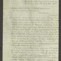
From Thomas Carney to Col. James B. Fry
-
Description
-
This letter, dated January 9, 1864, was written by Kansas Gov. Thomas Carney in Topeka, Kansas, to Col. James B. Fry, Provost Marshal General, in Washington, DC. Carney says that part of a letter he wrote to Fry was published in the Leavenworth Daily Conservative, “accompanied with scurrilous remarks.” Carney blames Capt. Sidney Clarke, Assistant Provost Marshal General, for publishing the letter, but leaves it up to Fry to determine Clarke's guilt.
-
Object Type
-
Government Document
-
Date
-
January 9, 1864
-

-
Title
-
Sectional Map of Kansas Territory
-
Description
-
This color map, dated April 1857, is entitled "Sectional Map of Kansas Territory." It was drafted by C.P. Wiggin and signed by L.A. MacLean, Chief Clerk of the Surveyor General’s office in Lecompton, Kansas Territory. MacLean certifies that the map was compiled from U.S. survey field notes. The map was published by MacLean and Lawrence and printed by William Schuchman and Bro. in Philadelphia.
-
Object Type
-
Map
-
Date
-
April 1857
-
-
Title
-
From Persifor Smith to M.C. Dickey
-
Description
-
This letter, dated July 23, 1856, is from Persifor Smith, a U.S. Army Major at Fort Leavenworth, to M.C. Dickey and “others, conductors of emigrating companies.” Smith responds to a letter in which Dickey and the others request military protection from armed bodies guarding the Kansas border. Smith denies their request: “I have no evidence that any parties are in arms to oppose you . . . I cannot act on your vague suspicions.”
-
Object Type
-
Letter
-
Date
-
July 23, 1856
-

-
Title
-
New Sectional Map of Kansas
-
Description
-
This color map, drafted in 1859 by Robert L. Ream, was published by Stevenson and Morris of St. Louis, and printed by A. Janicke and Co. of St. Louis. The map is entitled “New Sectional Map of Kansas,” and was compiled from the field notes in the Surveyor General’s office.
-
Object Type
-
Map
-
Date
-
1859
-

-
Title
-
Sectional Map of the Territory of Kansas
-
Description
-
This color map, entitled “Sectional Map of the Territory of Kansas,” was compiled from the field notes in the Surveyor General’s office. It was published in 1857 by John Halsall in St. Louis.
-
Object Type
-
Map
-
Date
-
1857
-

-
Title
-
Kansas and Nebraska 1856
-
Description
-
This color map, entitled “Kansas and Nebraska 1856,” was printed by J.G. Wells in New York.
-
Object Type
-
Map
-
Date
-
1856
-

-
Title
-
Map Showing the Progress of the Public Surveys in the Territories of Kansas and Nebraska
-
Description
-
This black-and-white map, signed by Ward B. Burnett, Surveyor General, was issued by the Surveyor General’s office in Nebraska City, Nebraska Territory on October 1, 1860. The map shows the progress of the public surveys in the territories of Kansas and Nebraska, and was produced to accompany the Surveyor General’s 1860 annual report.
-
Object Type
-
Map
-
Date
-
October 1, 1860
-

-
Title
-
Map Showing the Progress of the Public Surveys in the Territories of Kansas and Nebraska
-
Description
-
This black-and-white map, signed by Ward B. Burnett, Surveyor General, was issued by the Surveyor General’s office in Nebraska City, Nebraska Territory on October 1, 1859. The map shows the progress of the public surveys in the territories of Kansas and Nebraska, and was produced to accompany the Surveyor General’s 1859 annual report.
-
Object Type
-
Map
-
Date
-
October 1, 1859
-

-
Title
-
Map Showing the Progress of the Public Surveys in Kansas and Nebraska
-
Description
-
This black-and-white map, signed by Mark W. Delahay, Surveyor General, was issued by the Surveyor General’s office in Leavenworth, Kansas on September 2, 1861. The map shows the progress of the public surveys in Kansas and Nebraska, and was produced to accompany the Surveyor General’s report of 1861.
-
Object Type
-
Map
-
Date
-
September 2, 1861
-
-
Title
-
From Daniel Woodson to E.V. Sumner
-
Description
-
This dispatch, dated June 30, 1856, was sent by Acting Kansas Gov. Daniel Woodson in Lecompton, Kansas, to Col. E.V. Sumner at Fort Leavenworth, Kansas. Woodson states that the “bogus Legislature” of Free-Staters will undoubtedly meet at Topeka on July 4, 1856, and that Gen. Lane’s forces are believed to be approaching Topeka. Woodson has ordered Lt. Col. Philip St. George Cooke to secure the area between Fort Riley, Kansas, and Topeka. He instructs Sumner to go to Topeka personally with at least two more companies of U.S. troops.
-
Date
-
June 30, 1856
-

-
Title
-
Map Showing the Progress of the Public Surveys in the Territories of Kansas and Nebraska
-
Description
-
This black-and-white map, signed by J. Calhoun, Surveyor General, was issued by the Surveyor General’s office in Lecompton, Kansas Territory in October 1857. The map shows the progress of the public surveys in the territories of Kansas and Nebraska, and was produced to accompany the Surveyor General’s 1857 annual report.
-
Date
-
October 1857
