Error message
Notice: Trying to access array offset on value of type null in IslandoraSolrDisplayManagerResults->currentQueryDisplays() (line 222 of /var/www/drupal7/sites/all/modules/islandora_solr_display_manager/includes/islandora_solr_display_manager.inc).
-
-
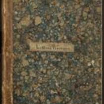
Title
-
Kansas Colored Volunteers Correspondence
-
Description
-
This bound letterbook contains copies of letters exchanged between the Adjutant General’s Office in Fort Scott, Kansas and various correspondents including the War Department in Washington. The letters relate to the recruitment and commission of troops and officers for the Kansas Colored Volunteers. Participants in the correspondence include Major General James G. Blunt, Major General J.M. Schofield, Secretary of War Edwin Stanton, and Kansas Governor Thomas Carney.
-
Date
-
1863-1864
-

-
Title
-
Sectional Map of Kansas Territory
-
Description
-
This color map, dated April 1857, is entitled "Sectional Map of Kansas Territory." It was drafted by C.P. Wiggin and signed by L.A. MacLean, Chief Clerk of the Surveyor General’s office in Lecompton, Kansas Territory. MacLean certifies that the map was compiled from U.S. survey field notes. The map was published by MacLean and Lawrence and printed by William Schuchman and Bro. in Philadelphia.
-
Object Type
-
Map
-
Date
-
April 1857
-

-
Title
-
New Sectional Map of Kansas
-
Description
-
This color map, drafted in 1859 by Robert L. Ream, was published by Stevenson and Morris of St. Louis, and printed by A. Janicke and Co. of St. Louis. The map is entitled “New Sectional Map of Kansas,” and was compiled from the field notes in the Surveyor General’s office.
-
Object Type
-
Map
-
Date
-
1859
-

-
Title
-
From Samuel R. Ayres to Lyman Langdon
-
Description
-
In this letter, dated November 15, 1861, Samuel R. Ayres tells Lyman Langdon that he recently travelled to Kansas City, Missouri on an expedition to escort a provision train, but the train was captured by Secessionists. Ayres tells Langdon that there are a lot of Secessionists in Clay County, Missouri, and he suspects that they will try to take possession of Kansas City. He also mentions a rumor that Gen. Lane is in danger, as his regiment is vastly outnumbered by the enemy, but he plans to unite his forces with those of Col. Jennison.
-
Date
-
November 15, 1861
-

-
Title
-
Map Showing the Progress of the Public Surveys in the Territories of Kansas and Nebraska
-
Description
-
This black-and-white map, signed by Ward B. Burnett, Surveyor General, was issued by the Surveyor General’s office in Nebraska City, Nebraska Territory on October 1, 1860. The map shows the progress of the public surveys in the territories of Kansas and Nebraska, and was produced to accompany the Surveyor General’s 1860 annual report.
-
Object Type
-
Map
-
Date
-
October 1, 1860
-

-
Title
-
Map Showing the Progress of the Public Surveys in the Territories of Kansas and Nebraska
-
Description
-
This black-and-white map, signed by Ward B. Burnett, Surveyor General, was issued by the Surveyor General’s office in Nebraska City, Nebraska Territory on October 1, 1859. The map shows the progress of the public surveys in the territories of Kansas and Nebraska, and was produced to accompany the Surveyor General’s 1859 annual report.
-
Object Type
-
Map
-
Date
-
October 1, 1859
-

-
Title
-
Map Showing the Progress of the Public Surveys in the Territories of Kansas and Nebraska
-
Description
-
This black-and-white map, signed by J. Calhoun, Surveyor General, was issued by the Surveyor General’s office in Lecompton, Kansas Territory in October 1857. The map shows the progress of the public surveys in the territories of Kansas and Nebraska, and was produced to accompany the Surveyor General’s 1857 annual report.
-
Date
-
October 1857
