Error message
Notice: Trying to access array offset on value of type null in IslandoraSolrDisplayManagerResults->currentQueryDisplays() (line 222 of /var/www/drupal7/sites/all/modules/islandora_solr_display_manager/includes/islandora_solr_display_manager.inc).
-
-
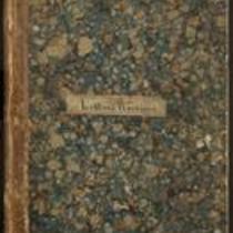
Title
-
Kansas Colored Volunteers Correspondence
-
Description
-
This bound letterbook contains copies of letters exchanged between the Adjutant General’s Office in Fort Scott, Kansas and various correspondents including the War Department in Washington. The letters relate to the recruitment and commission of troops and officers for the Kansas Colored Volunteers. Participants in the correspondence include Major General James G. Blunt, Major General J.M. Schofield, Secretary of War Edwin Stanton, and Kansas Governor Thomas Carney.
-
Date
-
1863-1864
-
-
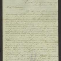
Title
-
From Wilson Shannon to E.V. Sumner
-
Description
-
This dispatch, dated May 21, 1856, was sent by Kansas Gov. Wilson Shannon in Lecompton, Kansas, to Col. E.V. Sumner at Headquarters, Fort Leavenworth, Kansas. Due to recent civil unrest in Lawrence, Kansas, Shannon instructs Sumner to station companies of U.S. troops at or near Lawrence, Lecompton, and Topeka, Kansas. Shannon explains that federal troops are the only ones he feels safe using in response to “these civil commotions.” He notes that the U.S. Marshal has made several arrests for the crime of high treason.
-
Date
-
May 21, 1856
-
-
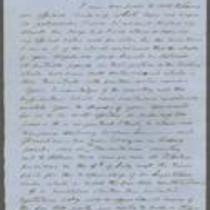
Title
-
From Wilson Shannon to E.V. Sumner
-
Description
-
This letter, dated June 23, 1856, was sent by Kansas Gov. Wilson Shannon in Lecompton, Kansas, to Col. E.V. Sumner. Shannon, who is leaving for St. Louis, instructs Sumner to station U.S. troops in areas where disturbances have recently occurred, and to station two companies at Topeka before the Free State legislative assembly meets on July 4th. Shannon believes that “if this body meets, enacts laws, and seeks to enforce them…civil war will be the inevitable result.” He orders Sumner to disband the assembly by force if necessary.
-
Date
-
June 23, 1856
-
-
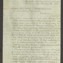
Title
-
From Persifor Smith to M.C. Dickey
-
Description
-
This letter, dated July 23, 1856, is from Persifor Smith, a U.S. Army Major at Fort Leavenworth, to M.C. Dickey and “others, conductors of emigrating companies.” Smith responds to a letter in which Dickey and the others request military protection from armed bodies guarding the Kansas border. Smith denies their request: “I have no evidence that any parties are in arms to oppose you . . . I cannot act on your vague suspicions.”
-
Object Type
-
Letter
-
Date
-
July 23, 1856
-

-
Title
-
From Wilson Shannon to E.V. Sumner
-
Description
-
This dispatch, dated June 23, 1856, was sent by Kansas Gov. Wilson Shannon in Lecompton, Kansas, to Col. E.V. Sumner. Shannon, who says he will soon leave for St. Louis, urges Sumner to attend the meeting of the Topeka legislature. Shannon indicates that he fears an outbreak of violence will occur if U.S. troops are withdrawn from Kansas, and says he will write to President Pierce saying so. Shannon requests that Sumner make no changes with the troops until he returns in ten days’ time.
-
Date
-
June 23, 1856
-

-
Title
-
Nebraska and Kanzas
-
Description
-
This color map, ca. 1854-1861, is entitled “Nebraska and Kanzas.” It was printed by J.H. Colton and Co. in New York.
-
Object Type
-
Map
-
Date
-
1854-1861
-
-
Title
-
From A.J. Huntoon to Lizzie P. Huntoon
-
Description
-
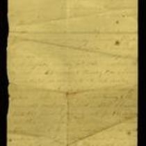
In this letter, dated July 17 and July 20, 1861, A.J. Huntoon writes to his wife Lizzie P. Huntoon. On July 17, A.J. writes from Camp Lincoln, headquarters of the 3rd Regiment, Kansas Volunteers, in Fort Leavenworth, Kansas. A.J. describes his trip from Topeka to Fort Leavenworth, stating that four companies are in camp there, while another five have gone to Kansas City. On July 20, A.J. reports he is in camp at Kansas City, where there are rumors of an imminent secessionist attack; he believes there is no great danger.
-
Date
-
July 17, 1861-July 20, 1861
-

-
Title
-
New Sectional Map of Kansas
-
Description
-
This color map, drafted in 1859 by Robert L. Ream, was published by Stevenson and Morris of St. Louis, and printed by A. Janicke and Co. of St. Louis. The map is entitled “New Sectional Map of Kansas,” and was compiled from the field notes in the Surveyor General’s office.
-
Object Type
-
Map
-
Date
-
1859
-
-
Title
-
From A.J. Huntoon to My Dear Wife
-
Description
-
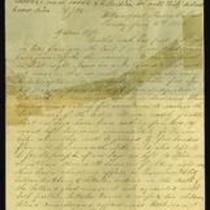
A.J. Huntoon writes a letter from Williamsport in Shawnee County, Kansas to his wife Lizzie, reporting that Rebels have fired at U.S. troops in Independence, Missouri. He adds that hundreds of Kansas troops have left Lawrence and Fort Leavenworth to assist U.S. troops in Kansas City and St. Joseph, Missouri. The letter, dated June 16 and 19, 1861, also mentions recent shootings in Leavenworth and Atchison, Kansas. Huntoon writes, “We may look for these as common occurrences in Kansas, for a while at least. All carry arms now . . . Men are paying out their last cent for them.”
-
Date
-
June 16, 1861-June 19, 1861
-

-
Title
-
Sectional Map of the Territory of Kansas
-
Description
-
This color map, entitled “Sectional Map of the Territory of Kansas,” was compiled from the field notes in the Surveyor General’s office. It was published in 1857 by John Halsall in St. Louis.
-
Object Type
-
Map
-
Date
-
1857
-

-
Title
-
Kansas and Nebraska 1856
-
Description
-
This color map, entitled “Kansas and Nebraska 1856,” was printed by J.G. Wells in New York.
-
Object Type
-
Map
-
Date
-
1856
-
-
Title
-
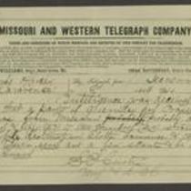
From Samuel R. Curtis to Edmund G. Ross
-
Description
-
This telegram, dated 1864, is from Major Samuel R. Curtis at Fort Leavenworth to Edmund G. Ross in Lawrence, Kansas. Curtis reports that 150-200 Missouri guerrillas have entered Kansas and are likely to invade Olathe, Lawrence, and Topeka. He tells Ross to warn Topeka of a possible attack and urges him to “be on your guard.”
-
Object Type
-
Telegram
-
Date
-
1864
-

-
Title
-
Map Showing the Progress of the Public Surveys in the Territories of Kansas and Nebraska
-
Description
-
This black-and-white map, signed by Ward B. Burnett, Surveyor General, was issued by the Surveyor General’s office in Nebraska City, Nebraska Territory on October 1, 1860. The map shows the progress of the public surveys in the territories of Kansas and Nebraska, and was produced to accompany the Surveyor General’s 1860 annual report.
-
Object Type
-
Map
-
Date
-
October 1, 1860
-

-
Title
-
Map Showing the Progress of the Public Surveys in the Territories of Kansas and Nebraska
-
Description
-
This black-and-white map, signed by Ward B. Burnett, Surveyor General, was issued by the Surveyor General’s office in Nebraska City, Nebraska Territory on October 1, 1859. The map shows the progress of the public surveys in the territories of Kansas and Nebraska, and was produced to accompany the Surveyor General’s 1859 annual report.
-
Object Type
-
Map
-
Date
-
October 1, 1859
-

-
Title
-
Map Showing the Progress of the Public Surveys in Kansas and Nebraska
-
Description
-
This black-and-white map, signed by Mark W. Delahay, Surveyor General, was issued by the Surveyor General’s office in Leavenworth, Kansas on September 2, 1861. The map shows the progress of the public surveys in Kansas and Nebraska, and was produced to accompany the Surveyor General’s report of 1861.
-
Object Type
-
Map
-
Date
-
September 2, 1861
-
-
Title
-
From Daniel Woodson to E.V. Sumner
-
Description
-
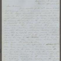
This dispatch, dated June 30, 1856, was sent by Acting Kansas Gov. Daniel Woodson in Lecompton, Kansas, to Col. E.V. Sumner at Fort Leavenworth, Kansas. Woodson states that the “bogus Legislature” of Free-Staters will undoubtedly meet at Topeka on July 4, 1856, and that Gen. Lane’s forces are believed to be approaching Topeka. Woodson has ordered Lt. Col. Philip St. George Cooke to secure the area between Fort Riley, Kansas, and Topeka. He instructs Sumner to go to Topeka personally with at least two more companies of U.S. troops.
-
Date
-
June 30, 1856
-

-
Title
-
Map Showing the Progress of the Public Surveys in the Territories of Kansas and Nebraska
-
Description
-
This black-and-white map, signed by J. Calhoun, Surveyor General, was issued by the Surveyor General’s office in Lecompton, Kansas Territory in October 1857. The map shows the progress of the public surveys in the territories of Kansas and Nebraska, and was produced to accompany the Surveyor General’s 1857 annual report.
-
Date
-
October 1857
