
The missouri-kansas conflict 1854-1865
Error message
Notice: Trying to access array offset on value of type null in IslandoraSolrDisplayManagerResults->currentQueryDisplays() (line 222 of /var/www/drupal7/sites/all/modules/islandora_solr_display_manager/includes/islandora_solr_display_manager.inc).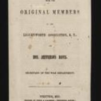


Local Subject
People
- Frederick Starr (2)
- --> (1)
- A. Janicke and Co. (Lithographer) (1)
- A.T. Kyle (1)
- Daniel Stevens (1)
- Edward Mix (1)
- Finch & O’Gorman (1)
- Franklin Pierce (1)
- George H. Keller (1)
- H. Miles Moore (1)
- J. Calhoun (1)
- J.F. Bruner (1)
- J.S. Todd (1)
- James Hardesty (1)
- James Henry Lane (1)
- Jefferson Davis (1)
- John Bachmann (1)
- John Bull (1)
- John C. Gist (1)
- John Halsall (1)
- Joseph B. Evans (1)
- Joseph Murphy (1)
- L.A. Wisely (1)
- L.D. Bird (1)
- L.W. Caples (1)
- Malcolm Clark (1)
- Mark W. Delahay (1)
- Merit Johnson (1)
- Oliver Diefendorf (1)
- Robert L. Ream (1)
- Samuel Fernandis (1)
- Samuel Few (1)
- Samuel Norton (1)
- Stevenson and Morris (1)
- W.G. Caples (1)
- W.H. Adams (1)
- W.S. Murphy (1)
Geographic Subject
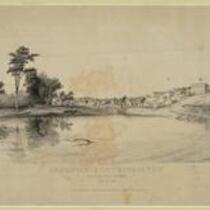
- Fort Leavenworth, Kansas (7)
- Leavenworth County, Kansas (7)
- Leavenworth, Kansas (6)
- Bourbon County, Kansas (3)
- Doniphan County, Kansas (3)
- Douglas County, Kansas (3)
- Fort Scott, Kansas (3)
- Kansas City, Missouri (3)
- Lawrence, Kansas (3)
- Lecompton, Kansas (3)
- Platte County, Missouri (3)
- Shawnee County, Kansas (3)
- Topeka, Kansas (3)
- Atchison County, Kansas (2)
- Atchison, Kansas (2)
- Buchanan County, Missouri (2)
- Franklin County, Kansas (2)
- Jackson County, Kansas (2)
- Jackson County, Missouri (2)
- Johnson County, Kansas (2)
- Linn County, Kansas (2)
- St. Joseph, Missouri (2)
- Wyandotte County, Kansas (2)
- Brown County, Kansas (1)
- Jefferson County, Kansas (1)
- Osage County, Kansas (1)
- Quindaro, Kansas (1)