Error message
Notice: Trying to access array offset on value of type null in IslandoraSolrDisplayManagerResults->currentQueryDisplays() (line 222 of /var/www/drupal7/sites/all/modules/islandora_solr_display_manager/includes/islandora_solr_display_manager.inc).
-
-
Title
-
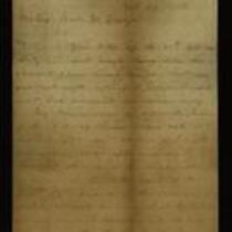
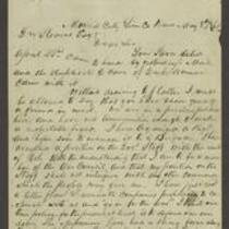
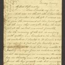
From S.G. Cato to John W. Geary
-
Description
-
This letter, dated October 29, 1856, is from Judge S.G. Cato in Shawnee County, Kansas to Gov. John W. Geary. Cato reports on the judicial proceedings he has presided over as Associate Justice of the Kansas Supreme Court. He lists the number of bills of indictment returned by grand juries in Anderson, Allen, Lykins, Bourbon, Franklin, and Shawnee counties, and reports that three criminal trials have been held in Bourbon County.
-
Date
-
October 29, 1856
-
-
Title
-
From James Montgomery to George L. Stearns
-
Description
-
James Montgomery writes a letter from Mound City, Kansas to George L. Stearns on May 8, 1861. He reports that, “We are in a perilous position here, and have not ammunition enough to make a respectable fight.” He says that he has organized a regiment to help defend Kansas against pro-slavery Missourians, whose troops are camped along the border of Linn and Bourbon counties. He mentions that an Osage Indian chief attacked some of these troops, then “tied them with ropes to the Horns of his Saddles and dragged them out of the country.” Montgomery asks for Stearns’s assistance in acquiring arms and declares that, “If we have to fight, we will carry the war out of Kansas.”
-
Date
-
May 8, 1861
-
-
Title
-
From A.J. Huntoon to My Dear Wife and Boy
-
Description
-
This letter, dated October 6, 7, 10, and 11, 1861, is from A.J. Huntoon to his wife Lizzie and son Prentice. Huntoon, a member of the 5th Kansas Cavalry volunteer regiment, tells his family that he was ordered to take charge of a military hospital in Mapleton, Bourbon County, Kansas. He estimates that there are 50,000-55,000 Union soldiers in Missouri, including the companies of Generals Sturgis, Siegel, and Fremont, and that there are about 70,000 Confederate troops in Missouri under the commandment of Generals McCulloch and Rains. Huntoon predicts that “We will have a big battle in this vicinity ere so long.”
-
Date
-
October 6, 1861-October 11, 1861
-
-
Title
-
From Florella Brown Adair to Samuel Lyle Adair and Emma Adair
-
Description
-
This letter, dated November 21, 1860, was written by Florella Brown Adair in Hudson, Ohio to her husband Samuel Lyle Adair and daughter Emma in Osawatomie, Kansas. Florella responds to their recent letters, which were “so complaining and discouraging, that I feel more like staying away, than hurrying home…it seems to me that the Territory is cursed of the Lord and that it is fighting against him to try to live there and do anything but barely to exist…I cannot help feeling a perfect disgust for Kansas life, and most of Kansas people.” Florella adds that she read about the “Montgomery and Fort Scott troubles” in the newspapers.
-
Object Type
-
Letter
-
Date
-
November 21, 1860
-

-
Title
-
Sectional Map of Kansas Territory
-
Description
-
This color map, dated April 1857, is entitled "Sectional Map of Kansas Territory." It was drafted by C.P. Wiggin and signed by L.A. MacLean, Chief Clerk of the Surveyor General’s office in Lecompton, Kansas Territory. MacLean certifies that the map was compiled from U.S. survey field notes. The map was published by MacLean and Lawrence and printed by William Schuchman and Bro. in Philadelphia.
-
Object Type
-
Map
-
Date
-
April 1857
-

-
Title
-
New Sectional Map of Kansas
-
Description
-
This color map, drafted in 1859 by Robert L. Ream, was published by Stevenson and Morris of St. Louis, and printed by A. Janicke and Co. of St. Louis. The map is entitled “New Sectional Map of Kansas,” and was compiled from the field notes in the Surveyor General’s office.
-
Object Type
-
Map
-
Date
-
1859
-

-
Title
-
Sectional Map of the Territory of Kansas
-
Description
-
This color map, entitled “Sectional Map of the Territory of Kansas,” was compiled from the field notes in the Surveyor General’s office. It was published in 1857 by John Halsall in St. Louis.
-
Object Type
-
Map
-
Date
-
1857
-

-
Title
-
Kansas and Nebraska 1856
-
Description
-
This color map, entitled “Kansas and Nebraska 1856,” was printed by J.G. Wells in New York.
-
Object Type
-
Map
-
Date
-
1856
-

-
Title
-
Map Showing the Progress of the Public Surveys in the Territories of Kansas and Nebraska
-
Description
-
This black-and-white map, signed by Ward B. Burnett, Surveyor General, was issued by the Surveyor General’s office in Nebraska City, Nebraska Territory on October 1, 1860. The map shows the progress of the public surveys in the territories of Kansas and Nebraska, and was produced to accompany the Surveyor General’s 1860 annual report.
-
Object Type
-
Map
-
Date
-
October 1, 1860
-

-
Title
-
Map Showing the Progress of the Public Surveys in the Territories of Kansas and Nebraska
-
Description
-
This black-and-white map, signed by Ward B. Burnett, Surveyor General, was issued by the Surveyor General’s office in Nebraska City, Nebraska Territory on October 1, 1859. The map shows the progress of the public surveys in the territories of Kansas and Nebraska, and was produced to accompany the Surveyor General’s 1859 annual report.
-
Object Type
-
Map
-
Date
-
October 1, 1859
-

-
Title
-
Map Showing the Progress of the Public Surveys in the Territories of Kansas and Nebraska
-
Description
-
This black-and-white map, signed by Ward B. Burnett, Surveyor General, was issued by the Surveyor General’s office in Nebraska City, Nebraska Territory on October 1, 1858. The map depicts the progress of the public surveys in Kansas and Nebraska in 1858, and was created to accompany the Surveyor General's report of that year. The map was printed by C.B. Graham Lithographers in Washington, DC.
-
Date
-
October 1, 1858
-

-
Title
-
Map Showing the Progress of the Public Surveys in the Territories of Kansas and Nebraska
-
Description
-
This black-and-white map, signed by J. Calhoun, Surveyor General, was issued by the Surveyor General’s office in Lecompton, Kansas Territory in October 1857. The map shows the progress of the public surveys in the territories of Kansas and Nebraska, and was produced to accompany the Surveyor General’s 1857 annual report.
-
Date
-
October 1857
